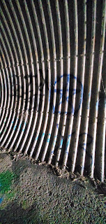
McNary Dam - Plymouth Abandoned Train Tunnel - Army Corp Engineering Recreation - Oregon / Washington Border
Watch this video for a walking tour of the tunnel and Dam overlook:
Check out how amazing and eerie the tunnel is in the pitch black dark!!
Also called.... The caves!
The McNary Dam is located at Columbia River Mile (RM) 292.5, at the head of Lake Umatilla, the reservoir created by the John Day Dam. McNary Dam spans the Columbia River from Umatilla, Oregon, to Plymouth, Washington, at a location once known as the "Umatilla Rapids". Lewis and Clark refered to these rapids as the "Muscle Shell Rapids". Immediately downstream of McNary Dam is McNary Wildlife Nature Area and the Interstate 82/395 Bridge. Sillusi Butte is on the Washington side below the dam and was noticed by Captain Clark. Upstream from McNary Dam can be found McNary Beach, Warehouse Beach, and Sand Station, all managed by the U.S. Army Corps of Engineers. Hat Rock and Boat Rock are also located upstream of McNary Dam on the Oregon side. Lake Wallula, the reservoir behind McNary Dam, extends 64 miles upstream and reaches as far as the mouth of the Yakima River. Lewis and Clark first passed through this area on October 19, 1805, and again on their return in April, 1806, where they camped downstream of McNary Dam near Plymouth, Washington.
McNary Dam History ...
In 1945, Congress authorized construction of a dam at the Umatilla Rapids, naming it after the late U.S. Senator, Charles McNary. It awarded the first contract for construction in April, 1947. By 1950, part of the lock, fishway and spillway rose above ground on the Washington shore. A year later barges headed upriver. Construction was completed in 1954, with all power units in operation by February 1957.
McNary Dam is 7,365 feet long, and rises approximately 183 feet above the streambed. It consists of a concrete structure with an earthfill embankment at the Oregon (south) abutment. The spillway is a concrete, gravity-type spillway dam, 1,310 feet long, and contains twenty-two 50x51 feet vertical lift gates. The dam's crest is at elevation 291 mean sea level, which is designed to pass a design flood of 2,200,000 cubic feet per second.
McNary Dam is located at Columbia River Mile 292, and raises the normal water surface about 85 feet. The project was originally called the Umatilla Dam, but the River and Harbor Act of 1945 renamed the dam in honor of the late Senator Charles L. McNary (U.S. Senator from Oregon, 1917-1944).
For
inquiries, promotions, influencing products, reviews, commercial, photography,
publications or other correspondence: StarRocksNoDrama@gmail.com
Instagram, Twitter, TikTok : StarzJeepCrew


No comments:
Post a Comment